Click on picture to enlarge
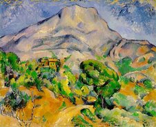
Here's a picture I took yesterday. It's that defining view of Antibes, the one you see on the picture postcards, and a favourite subject for generations of artists (eg see the Monet in the margin).
As you can see, there's a clear view of the snow-capped (pre-) Alps in the background. That's down to the mistral, which always brings cool*, clear air from the north. What newcomers to Antibes often don't appreciate is that some of the highest peaks that one sees behind the two Saracen towers are, in fact, inside Italy. For example, the tall peak that you see, halfway between the palm and the first tower, is Argentera (3290 metres); It's some 66 km ( just over 40 miles) from Antibes as the crow flies, and just inside Italy.
If you look at a map, you will see that although the Italian border begins some 30 miles east of Antibes, just beyond Menton, it curves in behind Nice and Antibes, before turning north.
There's plenty of snow, needless to say, at our nearest ski resorts, eg. Valberg, about 90 minutes drive away.
It's rare for those who visit Antibes in July or August to get a view of that stunning mountain backdrop. That's because of the usually persistent heat haze.
* The Antibois consider it "cool" right now, but it's all relative. The outside air temperature on our windowsill was 12°C first thing this morning. It's presently a pleasant 16.5°, at 13.33 local time.