What you see is the orientation table, labelled with compass points, landmarks and other data. Nerdish nirvana !
Here's what the article said ( translation provided by J, my wife).
"Garoupe Plateau: the orientation table that does not run smoothly" (there's some word play there that does not translate smoothly, based on the fact that the table is wheel-shaped)
The geographical features shown on the viewing table on the Garoupe plateau are allegedly not correct. With ref. to the article "Under the flagstones" by M.Petiti (Nice-Matin etc) about the location indicator at the Garoupe lighthouse, one of our readers wanted to add a point.
"I've just found out about the forthcoming restoration shortly to be carried out. The table was made from Auvergne lava and its constructor lived in Riom. For a long while now I have been puzzled by the geographical features shown on this indicator. It reads: latitude: 48° 40' 50'' and longitude: 5°30. These are definitely not the exact coordinates for Antibes which are: latitude North 43°34 and longitude East 07°06. There must have been an error in the making........ (the writer then goes on to say that the coordinates are not the constructor's home town either, but relate to a place in eastern France, close to Nancy !). Still awake ? He continues:
"It would be good if this matter could be cleared up, and if there is indeed an error that it could be corrected during restoration. A word to the wise/in the right ear ....... "
Well, you can see the kind of thing that gets the Antibois literati going - and this is the new tabloid edition of Nice Matin !
Yawn provoking, perhaps, but for this Brit with a scientific (nerdish) disposition, there's a sting in the tail. You see, the street in which we live is named after the same local physicist/mathematician who back in 1927, had a hand in marking out that brass face of the table, with all those wildly inaccurate coordinates. I won't mention him by name, in case petit-fils de B. lives round the corner, and is bigger than me.
Well, if grandad did make a pig's ear of it, as would appear to be the case, then I might be tempted to campaign for the street to revert to its original name.
According our local fount of all knowledge to do with Antibes local history ( Gerard) the previous name, pre 1945, has nothing to do with blacksmiths, or stabling of horses, as commonly supposed, but signified that the original Roman aqueduct and later replacements passed along it. (There's a small surviving remnant of the original down near Port Vauban). Sorry, I'm digressing, as is my wont.
Anyway, our gloriously invigorating anticyclonic weather conditions are well established, with the same blue cloudless skies and superb visibility that you saw in my last post. So yesterday I thought I'd go up to the Garoupe, and get a picture from the same camera angle.
It's a brisk 25 minute walk, out of the Vielle Ville to the remparts, along the palm-lined promenades, and then the cardiovascular workout up the steep cobbled Chemin du Calvaire, past the dozen or so wayside shrines, each one a Station of the Cross, I understand, up to the church, lighthouse and viewing table at the top.
And yesterday's picture is alongside. As you can see, the tourists are still about, at least one of whom seems to think it's still August.
What you see is the view west, looking into the sun unfortunately, which obscures some detail (my lousy digital camera with bottle glass optics doesn't help, either despite being "state of the art" according to the lady in the Watford branch of Jessops).
Little has changed at first glance, except the vegetation which is now almost sub-tropical. Something that ought to have changed is the presence of those damn telegraph poles etc, that detract from the view (and photographs) of generations of tourists. Why can't they re-route the cable, or bury it ?
Just visible in the bay behind is the port of Golfe Juan, crammed with pleasure craft (the larger, better known Juan les Pins is closer, but hidden from view). Golfe Juan is where Napoleon disembarked his small band of die-hard supporters after escaping from detention on Elba. The first thing he had to do was find the small sign that reads Route Napoleon. It's easy to overlook in that bustling mile-long strip of commerce. From there he headed inland via Digne, Gap to Lyons. And the rest as they say is history . There's a Napoleonic museum at the end of the Cap d'Antibes, next to the Eden Roc hotel ( no credit cards accepted!), but I've so far failed to summon any enthusiasm for visiting it. When you read what his troops did to Venice .....
In fact earlier in his career Napoleon was billeted in Antibes,which has been a fortified town for millenia. His family lived in a small villa, apparently in somewhat straitened circumstances. He and his fellow soldiers were rarely paid on time. He even did a spell of porridge in the Fort Carré, having made himself temporarily unpopular with the revolutionaries in 1789.
I like to think that Napoleon would have coined an expression "Able was I ere I saw Antibes". But he wisely realised that he should save that for Elba, thus creating the best known palindrome. But it only works in English. Funny that. Maybe he was prescient.
Speaking of inscriptions, you may notice there's an addition to the upright of the viewing table (see photo) which does have an appreciative comment re Antibes.

It's from Guy de Maupassant and reads "Je n'ai rien vu de plus surprenant qu'Antibes debout sur les Alpes au soleil couchant" Translated (by me, and probably inaccurately) that reads "I have seen nothing more surprising than Antibes standing against the Alps in the setting sun. "
These days you're more likely to hear "It's good 'ere, innit".
If you click on the link to this website , you'll see it names Maupassant's view as 41st best out of 50 in the entire world. (Amazing, isn't it, what one turns up in Google searches ?). Trouble is their camera was pointing in wrong direction, away from Alps, towards the volcanic red porphry of the Esterel massif west of Cannes. Yes that's a good view as well, and from Garoupe, if you walk back and forth, you get to see both ! By that reckoning, Antibes' plateau de la Garoupe should by rights be up there in the top 20 !
 Here's the view looking east, with one's back (and camera lens) to the setting sun. Click to enlarge. You can just about make out Antibes iconic "twin towers", originally built as lookouts as an early warning system against Saracen raiders. There seems to be something about twin towers that attracts the wrong element. They were built, incidentally, of recycled stone from the Greek and Roman era. The Cours Massena in Antibes, and adjoining streets, especially the coastal side, exudes history.
Beyond that, across the Baie des Anges, you can see the modernistic Marina development at Villeneuve-Loubet, mentioned in a previous post. With a pair of binoculars one can make out a string of well-known tourist destinations: Cagnes old town, St.Paul de Vence, Vence, Nice, Peille, Peillon, Gourdon, Tourrettes etc etc. It's almost the equivalent of a Google Earth satellite picture, viewing that vast panorama.
But there's an annoying downside. According to the guide books, the view from the Garoupe takes in a vast stretch of Riviera from St. Tropez in the west to the Italian frontier in the east. That's true if you are viewing from the top of the lighthouse (phare), as was possible some three years ago (somewhere I have the pictures to prove it). But then they went and closed the Phare for renovation. It stayed closed for months, if not years, and now they have stuck a sign on the gate saying it's closed permanently to visitors. Result: one can now see no further east than Nice. That's a great shame, and again, a whisper in the right ear is needed.

The one you see in the picture is a replacement, built by the American military. Inevitably, there's been some muttering, and suggestions that it ought to be knocked down, and replaced with one that is closer to the original, which was apparently round rather than square.
I've tried several times now to tidy up the layout here at the end, but Blogger's bug-laden software fights each attempt to do so, wiping the pictures off screen. Since there's no Edit Reverse, one has no choice but to tediously log off and then log back on again, losing any edits made in that last session.
There will be just 3 more posts before Christmas: one on winter trips into the mountains behind Nice, another on a coach excursion we took with the local Antiboulenc society along the coast to Genoa, and finally one flagged earlier on that (subjectively) gorgeous Swiss Re tower ("The Gherkin") and its architect, Norman Foster. I'll then say a few words about my plans for the New Year. They involve a change of focus and direction, for which I recently registered a new blog called "Inside Antibes".


8 comments:
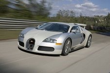
I'm not commenting on your re-posting - the missing photos have now appeared, but on the photo of the Bugatti - that is the most beautiful (and probably the most expensive) car in the world - if I were rich ....
I took the child to the last Geneva Motor Show where it was on display - that is one beautiful piece of motor car. Don't think the Mexican would fit in it - what a disgusting picture!
I think the new Bristol is faster - will have to ask my oracle about that (the child) and apparently they have rather a lot of problems with the Veyron which must be rather annoying when it has a £1M+ price tag!
City traders, with their multimillion pound bonuses, have been putting their names down for a Veyron - the ultimate status symbol. The waiting list has now got so long that there's an unofficial market developed : it allows you to progress faster up the waiting list (providing you don't mind paying way over the odds).
I'm waiting for a good package, like 0% finance, a year's subscription to the RAC, and a free set of rubber mats for the footwells.
I wouldn't be surprised if we see one up here this winter ...
Snow chains for a Veyron would have to be titanium, of course, which will set you back a further €45k (??? give or take). But what's that if you can afford the car in the first place (to say nothing of the insurance cover)?
Well, that's better!
How do you do the click on photo to enlarge, Colin?
Angela
just found out.
How embarrassing!
Angela
I was complaining about my new camera, Angela, but there's a surprising amount of detail visible when one clicks and enlarges. But I'm always making invidious comparisons between my own pix and your own, which are always pin sharp. So what kind of camera are you using ?
If you click on the 4th picture, you can see Old Cagnes (large cone), St.Paul de Vence (smaller one) and Vence itself (thin spread out).
Vence is a mystery to me. There's nowhere that I know of that gives a view to the Med, except possibly hotel balconies, private villas etc. ! Sure, there's a nice view of the three(?)Baous, but I can see those from Antibes.
Just testing. Problem with logging on to draft posts.
Post a Comment