Hello again. It's back to aerial spotting today - and an opportunity for me to finish off a little project that I started last year. This is proving to be quite a labour of love, assembling all the data on this page where I want it, and the brain-dead blogger software trying to undo my work at the same time. For example, you won't believe the number of times my picture captions have defaulted to the left hand side of the page each time I add more text at the bottom of the document. Or worse still, they migrate to somewhere far from their respective photographs, ending up buried in text ! Since I have few regulars so far (Sarah, Diane and now, apparently, that smouldering crotchety Anne Gilbert from Salut! ) I crave the indulgence of all three of you, and anyone else I may have overlooked, by putting up what I've done so far, warts an' all, and then returning to tweak it from time to time. I'd being doing this anyway, for two reasons, only one of which I can divulge here, namely that this blog is as much a personal archive as a diary, so is something that one tries progressively to refine, like avoiding split infinitives.
The other reason, the one he doesn't want you to know about, is that each time he returns to D&D's Edit mode, his hit counter (bottom of page) records an extra "visitor" to his blog. Oh, and watch your sentence length. How many more times do you have to be told ?
Get back to your campus, hippo, where you belong ! Look, it's alright for you, cocooned in that womb-like compartment of yours, but some of us have to survive in the real world !
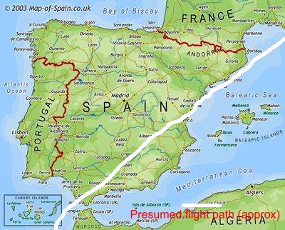 Our flight path across Spain (as deduced from the pictures below)
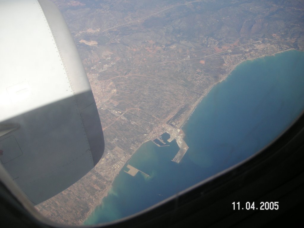
 We were flying from Casablanca to Nice, the second leg of our journey back from Marrakech. I had to make a decision as to which side of the aircraft to sit: I chose the port side which fortunately turned out to be the correct choice (would that it were always so). Once clear of
Casablanca, all I could see for quite a while was the Atlantic Ocean, but elementary geography told me that soon we would meet one of those Costas (Blanca ? Del Sol ? Lotza ? Del Concrete ?). But where, precisely ?
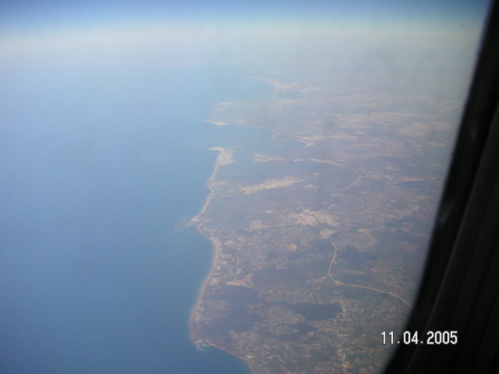
The photograph to the left ( as with all, one can click to enlarge) was that first glimpse. Not knowing mainland Spain south of Barcelona , a
Cadiz (in middle distance)
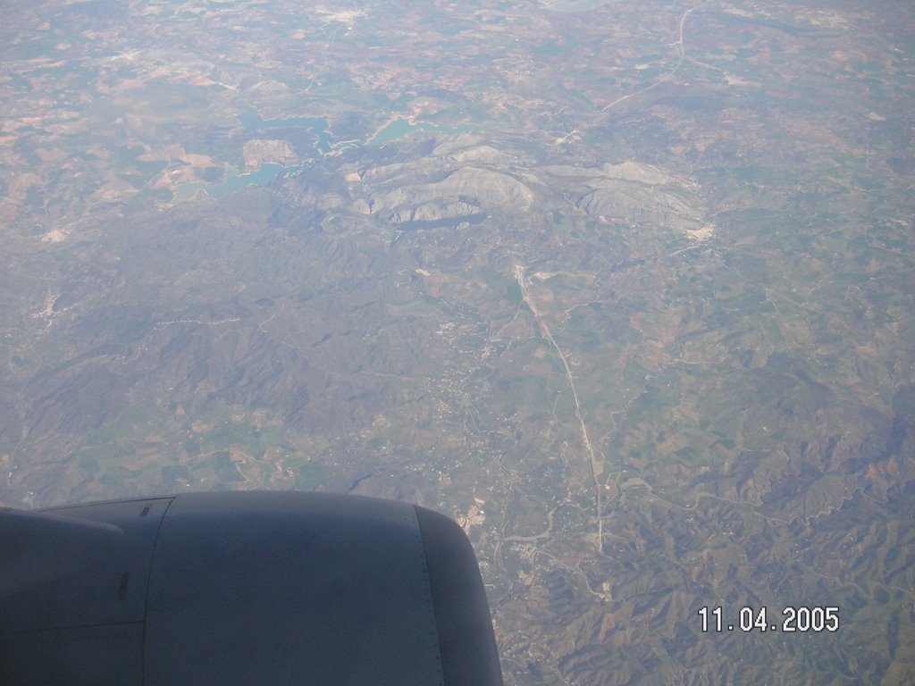 Good, I thought. That gives me the first land fix; right clicking on the photo, and then onto Properties in the menu, gave me the time the picture was taken. That would be useful very shortly. We then flew over a vast swathe of Spanish mainland - Andalusia etc, passing numerous lakes, reservoirs, mountain ridges. Anything that looked distinctive enough to be later matched up with maps I photographed. Anything else was ignored. The picture on the left shows a kind of three-leafed clover pattern of lakes. Possibly a dam and hydroelectic project. Where was that I wonder. Somewhere to call in when we return by car, and I can think - ah, I've Mystery lakes *
9.58 am
(ed: crazy software: I highlight a particular section for formatting, eg left justification, and it applies to everything else in the vicinity.)
seen you from 30,000 feet . The next fix, one that would allow permit retrospective identification of all points in between, would ideally be in "Green Spain", somewhere up in the north-east, and hopefully not some non-descript stretch of coastline that defied identification. As it happened Lady Luck was smiling that day
as we passed over the feature in the photograph
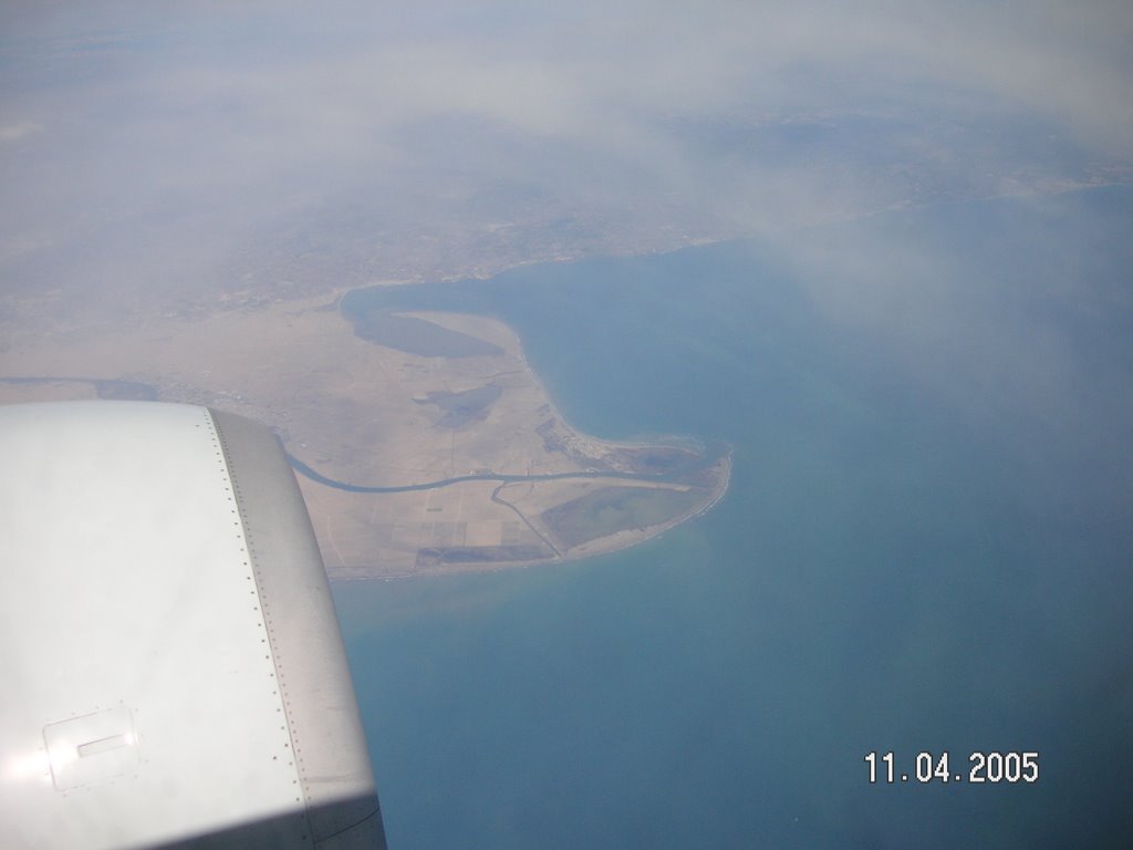
at the right - a tongue of land, jutting into the Med, bisected by a river, and almost certainly a river delta - the land being a deposit of silt brought down through the millenia - in short a Nile delta in miniature. I didn't know it at the time, such is (or was) the abysmal state of my knowledge of Iberian geography, but I was looking at the point at which one of Spain's major river's, the Ebro, enters the Med, dumping its cargo of eroded particles from its xxxx mile journey.
Ebro delta, 10.37am
(ed: no sense wasting any more time with positioning of text and photos: blogger software is fighting every change I make ! I leave the present dog's dinner as a snapshot in time of the software designers' limited success to date in achieving user-friendliness)
We next tracked up and along the Med coastline. Have you noticed how air traffic lanes tend to prefer land to sea, where the first is available - presumably to stay close to airports in the event
of emergencies. I took several pix of what clearly were seaside resorts, possibly big name ones that have a page to their own in the travel brochures, but for now they were simply places with distinctive looking harbour walls, breakwaters and the like that would aid identification later. And why is it I can never spell indentify or indentification correctly first time - always putting an "n" before the "d". Do you know why, hippo ?

apparently recogize that I'm something of an expert in matters related to the brain and its neural circuitry. It may well be due to the way that your brain is "hard-wired" so to speak.
OK Sounds a bit heavy, maybe we could return to that at a later date. Anyway, to get back to the matter in hand:
10.45 am
Here's my method. I've got fixes and times on two well-separated points, and a few destinations beyond. The first thing to do is to get a suitable map, draw a straight line between the two fixes, and measure off the distance between the points. From the time difference, one then calculates the
average ground speed, ie distance/time. What one does next is note the time on any mystery location, and figure out its distance between the fixed points. That then tells you which part of the map to concentrate on. The last step is to harness the power of the internet, to input the tentative identification into a google or other search engine, especially aerial or satellite photographs, with a view to obtaining a confident identification.
The final picture below needed no mapwork. It was our final approach towards Nice airport, one we've seen many times. The flight passes over the Esterel, a vivid red-bown massif of volcanic rock, over the TV mast at Pic d'Ours (in the picture) with the Cannes airstrip visible, then over glitzy Cannes, the neck of the Cap d'Antibes controversial Marina Baie des Anges, and finally touchdown.
 Esterel coastline, west of Cannes 11.43 am
And here finally is a picture off the internet of one of the the places that I have identified, taken from a different angle. Its called Castellon, and it's a little way south of the Ebro delta. Not particularly pretty - a container port or terminal by the looks of it, but chosen for its highly angular and distinctive outline that makes it an easy one for matching up one's pix with those on internet.
Off the internet
Mystery lakes located
And finally, here faintly circled in biro at the centre of this map is my tentative, nay 99.9% certain identification of the location of the mystery "clover-leaf lakes, in the picture above. This region of Spain is strewn with lakes (there's at least one, probably two others in the photograph) so how was this area pinned down for close scrutiny in the first place ? Answer, using the camera's internal clock. Here's how it was done.Earlier I said I had fixes on Cadiz and the Ebro delta. The two were taken at 9.48 and 10.45 am respectively, ie 57 minutes apart. The distance between the two on my map of Spain ( 1cm =10km) was 77cm, ie 770 km. An aside, first : those numbers indicate that the aircraft was travelling at a speed of 810 km/hr approx, ie 506mph in britspeak. Now then, the lakes were just 9 mins flying time from Cadiz, which is about 122km, or 12 cm approx on the map. So that tells us which bit of the map to study - the Malaga hinterland. It did not take long to spot our clover-leaf friends, just from their shape alone. In fact this one was too easy. I prefer harder ones, where one has to match up with other features, such as roads, rivers, hills, mountains, settlements etc.
It's 8.30 am. I am going to post "Spain" now, despite needing things done to it here and there.
I have decided, as a matter of policy, to conclude each post with a hint of what's in store for the next 24 or 48 hours.
A quick scan of the headlines shows there's been a breakthrough in the States on the causes of cot-death. There's apparently a genetic link. I'll take a close look at that, and record my first impressions.
And that worthy and lofty science will then be counterbalanced with a little idea I had yesterday for something on the chemisty of , wait for it, loo bowls, occasioned by my peeing into one yesterday into which my wife had left some strong bleach. Urine for a real laugh......
Oh, my God !
Oh yes, and something on the Taj Mahal, mentioned in a recent Telly blog as the world's most beautiful building. I've never been there (yet) but mere mention of the words Taj Mahal provokes some powerful memories from my teaching days.
PS : Message to Blogger software developers (in the hope you have search software that trawls for throwaway comments such as this ). What you need is to provide an option of attaching a caption-entry box to each uploaded graphic. It would be integral with that photo or whatever, such that the two move as a unit, and never get separated, as is clearly happening today in a totally unpredictable and infuriating manner.


No comments:
Post a Comment