It’s time to address another burning issue of the day. How far into Italy can one see from Antibes ?
Every tourist guide I have looked at so far, bar one, gives the same answer : the Bordighera headland ( see map below). Follow the blue line on the map from left (Antibes) to right (Capo S Ampelio peninsula and Bordighera).
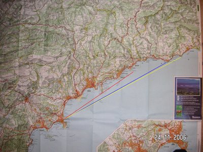
Sorry, it does not enlarge on clicking (possibly because it's been photo-edited)
The exception is Michelin’s Guide to the French Riviera, which has this to say:
(From Pointe Bacon on the Cap d'Antibes) one gets ........"a view of Antibes and Fort Carré extending across the Baie des Anges in front of Nice to Cap Ferrat and even Cap Martin near the Italian border. "
In other words, one follows the red sightline on the map, which does not even get as far as Italy !
Well, Monsieur Michelin, you may make good tyres, but your geography is awful. You see, Cap Martin is largely hidden from Antibes behind the Cap Ferrat peninsula.
But there’s another point worth mentioning: Cap Martin is a mere 35 km (approx 22 miles as the crow (seagull ?) flies from Antibes. That's less than the width of the English Channel at its narrowest, and we all know that the white cliffs of Dover are visible from France on a clear day.
I was in Menton yesterday, that splendid Riviera town which is the last one before the Italian border
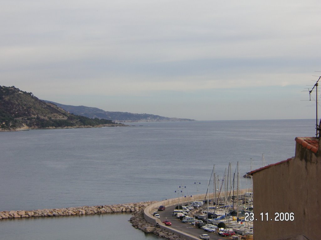
Here’s the view from the steps of the Cathedral, and yes - it is certainly the Bordighera peninsula that is the furthest one can see into Italy from Menton.
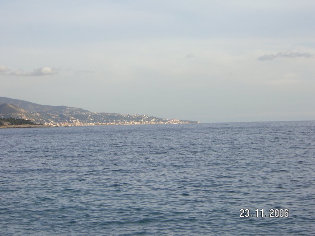
The next picture is the same view, on full zoom, from the promenade, taken with the benefit of a clearer sky.
One can just make out the raised clump of white buildings near the tip, which is Old Bordighera
But why do folk assume that what's true for Menton must be true for Antibes also ? Do they never look at a map ?
Bordighera is emphatically not the furthest one can see from ANTIBES. If you look at the map, one can see that next headland further east should be visible (follow the yellow sightline). It’s called Capo Nero, on which is situated the small resort town of Ospedaletti.
Here are two aerial pictures I took last year, on a flight heading eastwards out of Nice. The first is the Bordighera headland. 
Most of the development is close to the shore line. There is little, not much, extending up the hills behind, but little of Bordighera itself is visible from Antibes, due to it being below the horizon.

Here is the next headland going east. It's a lot more dramatic. It has steep terraced sides, with greenhouses and other structures that are easy to spot and identify through binoculars or telescope from afar (if one knows what to look for).
Patient work with binoculars has confirmed without a doubt that it is this prominent headland that one sees on a clear day from Antibes. It is Capo Nero on which sits Ospedaletti . It is a few kilometres further along the coast than Bordighera.
Here is a sharper, lower angle picture of Ospedaletti off the internet, which I used to confirm identification:

Every guide book, then, that I've seen is wrong. And I would guess they will probably continue to stay wrong, given the tendency of received wisdom in books to be endlessly recycled. The pessimist in me says this blog won't make one iota of difference !
Just to the north of Ospedaletti, the autostrada (A10/E80) crosses a viaduct and goes into a tunnel. One can see it my aerial view. Both the viaduct and tunnel entrance are visible through glasses from Antibes . And what an eery sight it is to see the endless convoys of HGVs, through the heat haze. Do you recall that memorable scene in Lawrence of Arabia, in which Omar Sharif gradually emerges wraith-like from the desert. ? That’s how those HGVs look, viewed from 35 miles away across the Med.
Note I have not said that Capo Nero is the furthest one can see into Italy. More on that for another day, says he with a gleam in his eye.
Ed. Late addition: if you look up "Bordighera" in Wikipedia, you will find a photograph taken from Bordighera's little harbour, looking east. And guess what is in the background ? Correct: Capo Nero, with Ospedaletti just visible as a huddle on the shoreline.
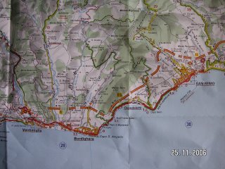
The map below shows the relationship between the Capo S Ampelio (Bordighera) and Capo Nero (Ospedaletti) in close up. This one has not been edited, so should enlarge on clicking.
To conclude: here are some pix taken yesterday in Menton that give a flavour of the place.
Up and till yesterday, I had only seen swallows on the wing, and was beginning to wonder if they ever roosted. Well, they do, on the upper stories of that fine belle époque hotel, the Palais de Toutou.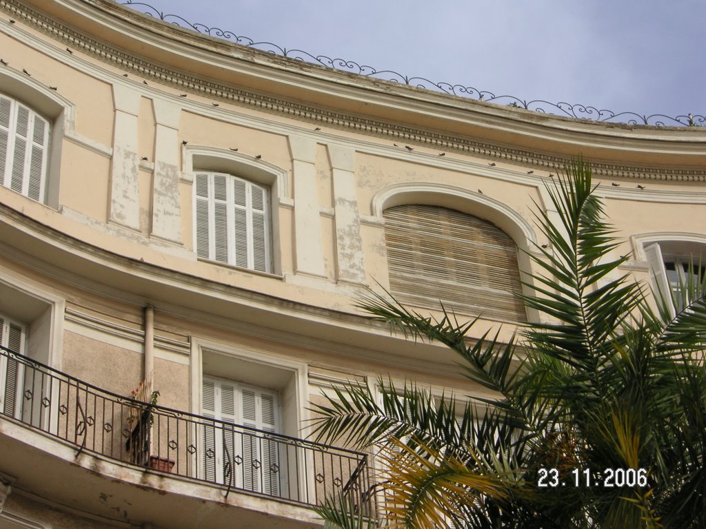
In the close up, you can see one on the wing, and several roosting.

Swallows are a discriminating lot, by the looks of it, liking to rest up in style , before heading back to winter in Africa. They presumably go via Corsica and Sardinia to minimize the time spent over water.
They say Corsica can be visible (just) from the Riviera mainland on clear cold days, especially February. I’ve seen a photograph taken from the celebrated Baou de St. Jeannet (the so-called Balcony of the Riviera, an iconic limestone outcrop , much favoured as a subject by painters). In that photo, Corsica's mountainous profile is just visible on the far horizon. We weren't able to see the so-called Ile de Beauté yesterday, or even its mountain tops , but there was maybe a hint of the island's cloud cover .
Here's the last hairdressing salon before the border.


1 comment:
Hi Colin,
thanks for the comment and sympathy. The person who replied from the Blogger help group thought I was delusional as it was coming through in English in Florida. I, however, was still looking at a French navbar and, yes, I agree the top of the page is hopelessly crowded.
The sitemeter can be moved, though.
Go back into sitemeter to, I think, html and click on Beta and it will give you instructions to paste the code. It's something like: go into layout, click Add Element, a pop up appears, choose add html, paste the code, click save changes etc
Did you notice if my Leave Your Comment Box was in English or French, by the way?
You can actually see Corsica very clearly on a clear day. It's visible as you say in February often but very early. My neighbour can see it but maybe Antibes is too West to get a good angle.
Angela
Post a Comment